The Barapullah Basin
Less than 50% of the population in India has access to safely managed drinking water. Two-thirds of India’s districts are affected by extreme water depletion, and the current lack of planning for water safety and security is a major concern. Additionally, it is estimated that waterborne disease has an economic burden of approximately $600 million USD a year. This is especially true for drought- and flood-prone areas, both of which have affected a third of the nation in the past few years. The fast rate of groundwater depletion in India is also a major challenge.
Delhi is a megacity of over 20 million people, with an ever-increasing water demand. Nearly 50% of Delhi’s water supply comes from the Yamuna River, but the megacity’s waste accounts for almost 60% of the river’s pollution. Inadequate urban drainage causes regular flooding, intensifying pollution and health hazards. Across the city there is significant variability in access to safe water supply – many non-piped households’ resort to pumping water directly from polluted groundwater sources.
Urban and regional water governance in the National Capital Territory (NCT) of Delhi is complicated, involving multiple jurisdictions including municipalities, state governments, and central government ministries, but lacking an integrated approach. Inter-state tensions and disputes over water resources and distribution are common. Balancing development and water security needs of urban and rural areas is a key challenge in the National Capital.
Delhi is divided into three major natural drainage sub-basins of the Yamuna, namely the Najafgarh, Barapullah, and Trans-Yamuna. Our India Collaboratory’s research is focused in the Barapullah Basin, approximately 376 km2 in size and located in the southern part of Delhi on the western bank of the Yamuna River. The sub-basin is home to around 3,389,000 people, approximately 20% of the NCT of Delhi’s total population. The Barapullah sub-basin (or drain), is the largest natural drain in the Yamuna basin, carrying around 80% of storm water from the area into the Yamuna.
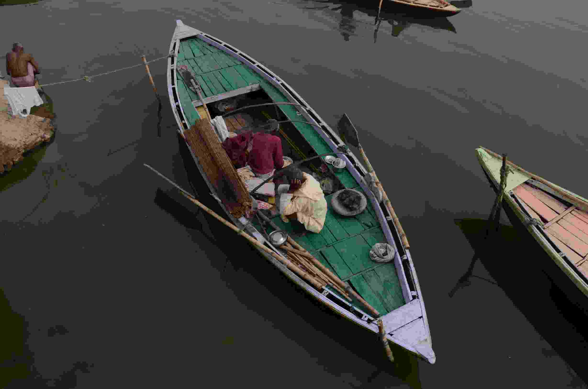
Two local boatmen in their green rowing boat on the River Ganges, Varanasi, India
Research
Our India Collaboratory’s objectives are to (1) extend and improve the network of water supply and sewerage in the National Capital Territory (NCT) of Delhi; (2) facilitate equitable and effective management of water resources by the government; (3) generate appropriate governance and regulatory frameworks that enable better integration of policies and plans across National Capital Region government departments; (4) enable more efficient use of water by the general public.
The India team is working across government scales and stakeholder groups to embed water management into urban planning, to realise Prime Minister Modi’s commitment to universal and equitable water security. Working closely with several organisations, including Delhi Jal Board (water utility agency) and Delhi Development Authority (city planning agency), our researchers are working to drive forward water sensitive planning (WSP) in urban development, and tackle water security in an equitable and conjoined manner. The India Collaboratory is already achieving impact through the introduction of water security as an element in the training of India’s urban planners, helping build capacity of future planning professionals to embed water sensitive practices in urban development plans, and better adapt to climate changes. The water sensitive planning approach is already being implemented by the Agra Development Authority.
The team is working with key stakeholders to assess flood, drought, sanitation, and water quality risks under current and future climates. The information collected allows stakeholders to understand water related climate change impacts on agriculture, hydropower generation and risks to people and public health. Researchers are also developing water capacity building through education, research, and collaboration in NCT of Delhi.
Using the IIT Delhi campus as a mini-township, water modelling prototype provides opportunities for testing tools and approaches, prior to wider deployment or scaling up. By integrating our geospatial data and modelling platforms with real time observations, a flood warning system for the Barapullah Basin has been implemented, providing three-day warnings for urban flooding. Our researchers are working with the National Mission for Clean Ganga (NMCG) to monitor and evaluate the effectiveness of various projects to clean the River Yamuna and address pollution. Hydrological modelling is being used to perform scenario- and simulation-based quantification of available surface water and groundwater. Water distribution modelling and risk simulations are also being carried out, alongside socioeconomic and financial analysis of water infrastructure at multiple scales, and evaluation of water risks using smart sensors.
The need to address the current separation of policies and functions was given new urgency during the COVID-19 pandemic, which further exposed the inequitable state of water supply and access throughout Delhi. Delhi’s water governance is complex and intertwined – using a systems approach the India team is analysing the city’s governance system, contributing to identification and THE addressing of cross-over and missing links. Hub researchers are actively informing several national policy agendas in India, including the National Capital Region Plan, 2014; the Master Plan for Delhi, 2041; and the Science, Technology, and Innovation Policy, 2020. Values are intrinsic to any decision-making process and comprehending individual and collective water values is critically important to generating sustainable water regimes. The India Collaboratory is carrying out research into stakeholder values and how to incorporate them into policy and planning.
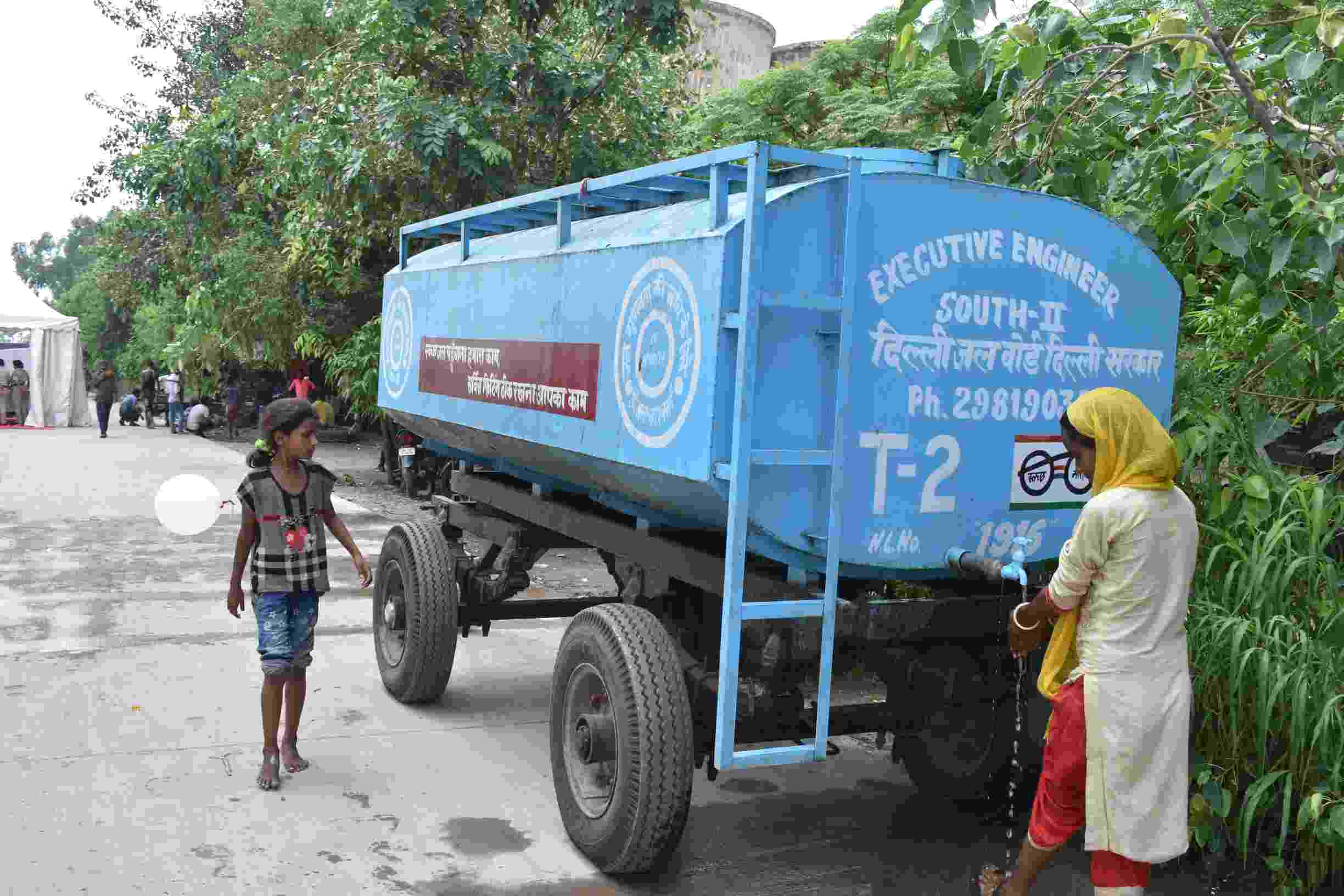
Tankers provide drinking water at the makeshift Yamuna flood relief camp
India Collaboratory leadership
The India Collaboratory is leading on the Hub’s research on water sensitive planning. Water sensitive planning integrates understanding about the urban water cycle, storm drainage networks, groundwater, wastewater management, and water supply, into every aspect of land use planning and urban design to tackle water security in an equitable and conjoined manner. Local community engagement is crucial to this research, which is linked to elements of water governance, water risks, and water values.
The team are also leading research on hydrological modelling; spatial integration and city planning; mapping of hydroclimatic and pollution risks and fluxes at different scales; economic analysis of the water sector; analysis of water availability; evaluating storm, sewerage and water supply networks; formulating a GIS-based framework for water infrastructure management; and the development of a real-time urban flood warning system.

The Ganga River represents multiple water values and uses - bathing, selling, transport are just some pictured here

The Yamuna river at dangerously high levels following the August 2019 flood

Makeshift Yamuna flood relief camp

Signature Bridge, Yamuna River

Rajaon ki baoli - one of Delhi's stepwells
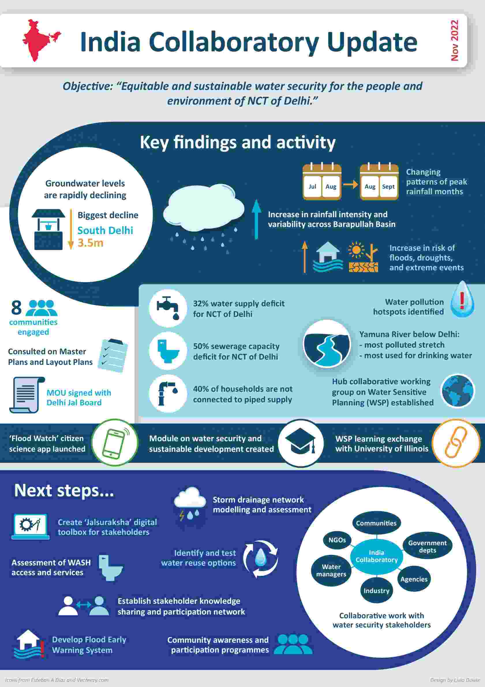
Take a look at this infographic that captures some of the India team's achievements to date, including key research findings and exciting next steps.