Groundwater in Ethiopia: current and future sustainability challenges
The case of the Central Rift Valley
24 March 2022
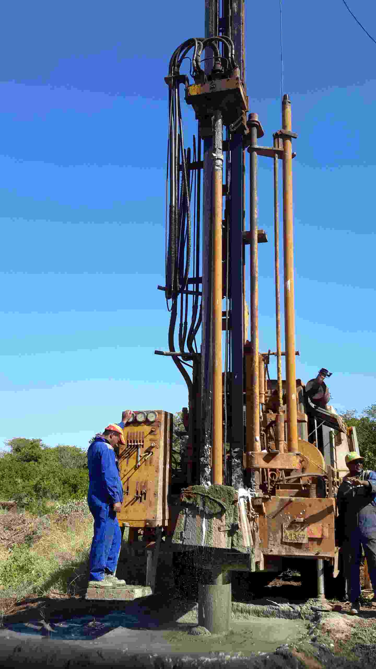
A groundwater borewell in Borena, Ethiopia
Dr Taye Alemayehu Hulluka
Groundwater in Ethiopia is a poorly understood, but widely used commodity. The biggest challenge in the management and allocation of water in Ethiopia is the limited knowledge on quantity, quality, and spatial distribution of groundwater resources. Providing logical estimates with the available meagre and unrealistic data, and the complex hydrogeological setup is difficult. However, by using better estimation methods and filling data gaps from recent works, attempts are being made to provide reasonable estimates. Kebede’s work (2013), for instance, offered a comprehensive analysis of groundwater resources in Ethiopia, demonstrating regional differences in groundwater potential, to fill knowledge gaps for practitioners and policy makers.
Groundwater recharge estimates for Ethiopia vary greatly, with assumptions made for mean annual weight recharge, and studies failing to consider unusable quantities of groundwater due to quality. Kebede estimated, for instance, that 30% of groundwater storage may be unavailable for direct use due to high salinity and high fluoride levels. These are prominent challenges in effectively quantifying available and usable groundwater resources in the Central Rift Valley (CRV), one of the Hub’s three study areas in Central Ethiopia.
The geological and structural setup of the CRV makes groundwater potential evaluation even more complex. The CRV forms part of the East African Rift Valley floor; the rift system runs north-east to south-west, controlling hydrogeological characteristics of the basin. Faults contributed to the formation of mountain ranges and hills in the valley, forming grabens and horsts. One of the prominent structures, the Wonji Fault Belt, is associated with the occurrence of springs that feed the lakes and thermal activity (Figure 1). The relationship between the lakes and wetlands, the connectivity with adjacent basins, the groundwater flow patterns at varying depths and their relationships with the fault swarms, are all under-researched - but pressing - issues.
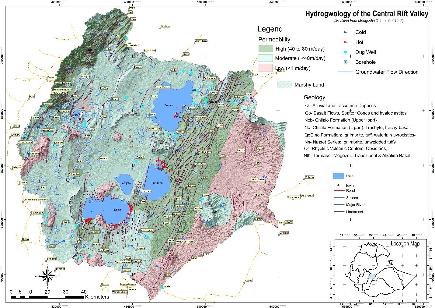
Figure 1: Hydrogeological map of CRV showing the geology, permeability and the NE-SW oriented fault swarms controlling groundwater flows
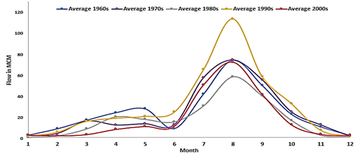
Figure 2: Long-term Meki River Average Monthly Flow, showing the diminishing flow and flow duration in the recent decade.
The CRV shares water security problems common throughout Ethiopia, including seasonal and spatial rainfall variability, and frequent drought and flood episodes. However, its hydrogeological setting raises unique challenges such as unmet water demands from ever-increasing irrigation, industry, and domestic supply. Over exploitation of surface water resources, climate variability, and changing land uses have resulted in springs drying-up, diminishing and disappearing perennial flows (Figure 2), and lakes’ shrinking. Geogenic and emerging anthropogenic water quality problems, resulting from pollution and contamination sources (including commercial farms, and domestic and industrial waste), are exacerbating the problem, affecting both shallow groundwater resources and fresh water bodies.
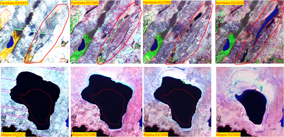
Figure 3: Diminishing trend of Abijata Lake (bottom) while new lake is emerging at the upstream side (top)
The severe basin-wide environmental degradation in recharge areas has made the problem critical. Lowering of the water tables, decreasing base-flow, increasing silt load towards the lakes floor, consequential expansion of mangroves and water hyacinth in freshwater bodies, and diminishing of the saline lakes (Figure 3) are results of the overall degradation. However, the degree of the problem facing the CRV is not the same across all catchments. While lakes at the downstream side of the CRV are diminishing, new lakes are emerging as wetlands in grabens are filled with clay and silt, washed from the highlands. A bathymetry survey, carried out for the first time as part of the Hub’s work, has shown the 7km long emerging lake ‘Harebata’, to have a maximum depth of 11 metres (Figure 4). Additional monitoring devices have been installed to measure seasonal and annual hydrological variabilities.
Although activities around the lakes are significant contributors, the main source of water insecurity in the CRV is basin-wide degradation. Studies fail to analyse impacts of the geological structures and the consequential emerging lakes and disappearing wetlands in upstream areas, and the increasing silt accumulation in the lakes. The inefficient irrigation water management practices, that do not allow return flows to river systems, are out of scrutiny, and the reduced baseflow due reduced groundwater recharge is little discussed.
Groundwater management is inseparable from surface water management. The CRV lake system is dependent on the groundwater system, as the lakes’ origins are associated with groundwater and geological processes, and they are fed through underground fractures. This makes understanding the groundwater-surface water interaction, studying hydraulic connectivity with adjacent basins, and impacts of changing land uses on water levels and quality priority areas of research, in order to help mitigate the risks the lakes environment in the CRV is facing.
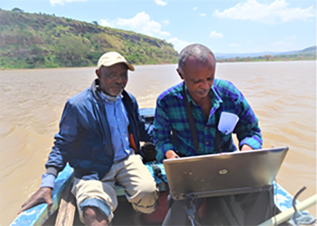
Figure 4 (i): Bathymetry survey on Lake Harebata
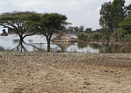
Figure 4 (ii): A recent flood around Lake Ziway, inundating 2000km2 of agricultural land (right)
