Blending high-resolution satellite rainfall estimates over urban catchment
Using Bayesian Model Averaging approach
05 December 2022
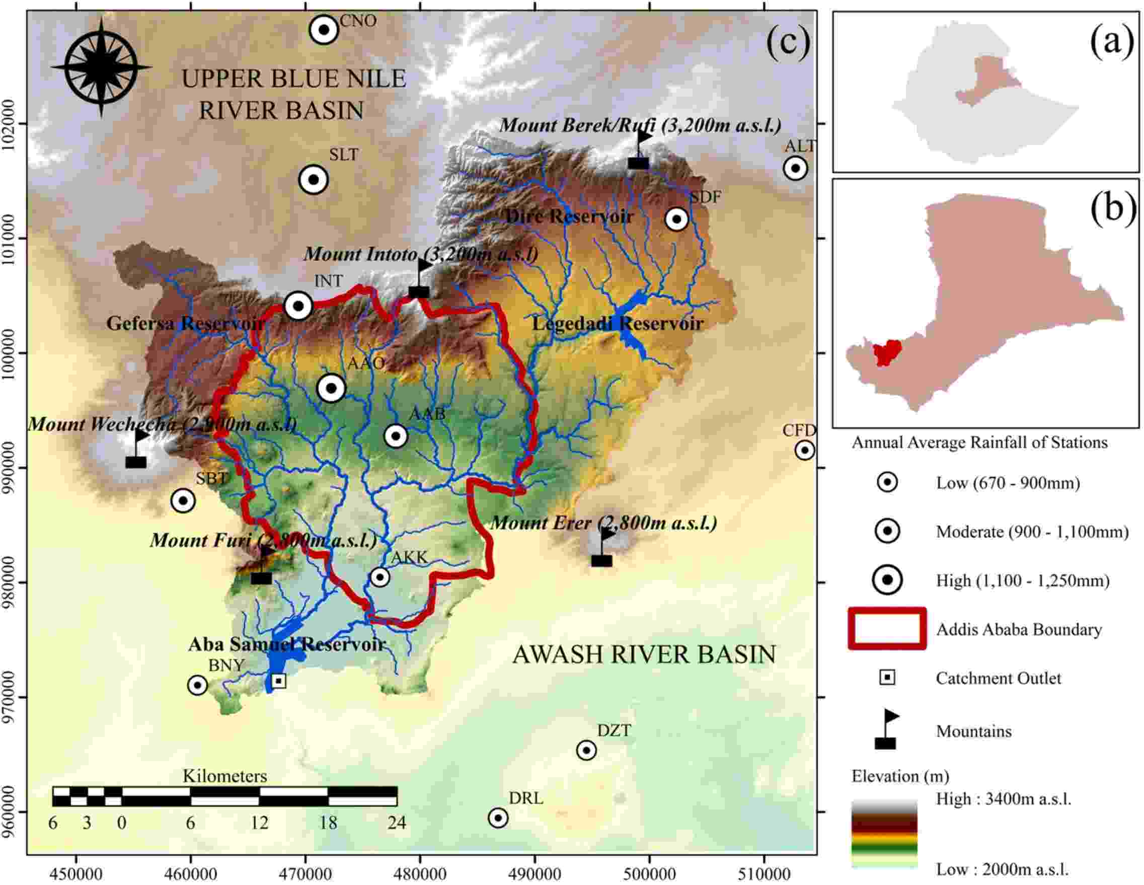
Geographic setting of Akaki catchment
Authors: Wegayehu Asfaw, Tom Rientjes, Alemseged Tamiru Haile
This study evaluates dynamic Bayesian Model Averaging (BMA) approach to improve rainfall estimation over the catchment by blending four high-resolution satellite rainfall estimate (SRE) products. Using daily data (2003–2019) observed at thirteen stations as a reference, seven statistical metrics served to assess the point and spatial scale accuracy of the rainfall estimates.
Highlights
- Blending high-resolution satellite products using the Bayesian Model Averaging (BMA) approach improved rainfall estimation.
- The blended rainfall product outperformed the individual satellite products by reducing the error of rainfall estimation.
- The blended and individual rainfall estimate products performed better in the highlands than the lowlands of the catchment.
- The rainfall during the main-rainy season was reasonably detected by the blended product than the individual SRE products.
Image:
Fig. 1. (a) Location of Awash River Basin in Ethiopia, (b) location of Akaki catchment in Awash River Basin, and (c) geographic setting of Akaki catchment relative to its hosting Awash River Basin and the adjacent, Blue Nile River Basin, in Journal of Hydrology: Regional Studies, under CC BY 4.0.
