
Social Cartography Participatory Workshops
Diana Ruíz, Rachael Maysels, Fernando Felipe Muñoz & Esteban Diaz
01 February 2023
Learning aims for this method:
- Provide an overview and understanding of social cartography as a qualitative-digital research method.
- Demonstrate the stages and ideology of this method, which can be applied around the world.
- Portray the value of participatory research and the co-creation of knowledge.
Introduction
Definitions
Social cartography can be understood as a participatory method used in transdisciplinary research that combines digital tools such as Geographical Information System (GIS) mapping software with qualitative methods such as focus groups, to co-construct maps among actors that visually and spatially represent the components, relationships, and dynamics of a specific territory.
'Territory' in this case, represents more than the physical space; it can be understood as a social construction, composed of biophysical elements and historical-cultural elements (Fals Borda, 2000) where social agents and power relations converge.
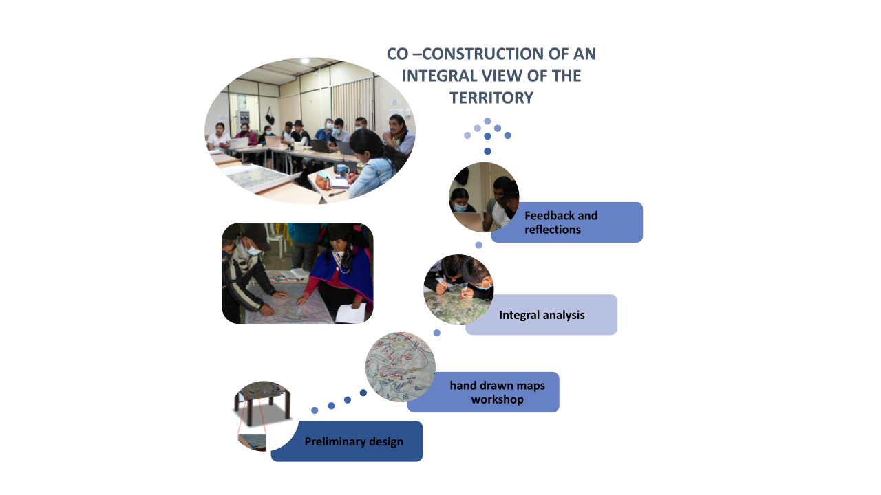
When working with the indigenous and campesino communities in the Kisgó reservation and Las Piedras river basin, the methodology was carried out in four stages:
- Preliminary design of the participatory workshop that will guide the activity to produce useful results.
- Carrying out the participatory workshop to produce hand drawn maps (the objective of the workshop was to recognize the territory from an aerial perspective and try to spatialize the geographic components that define its environment).
- Analysis and integration on digital platforms such as ArcGIS, QGIS, or Google Earth.
- Socialization: a process of interaction with these maps by the community, offering an opportunity for reflection, feedback, and iteration of the results.
Differentiating this method from adjacent/similar methods
Cartography as an art and science has been one of the pillars of human evolution (and exploitation) . The "official" cartographies are accepted as real and unquestionable representations despite being the result of "interested visions" that a hegemonic power exerts over territories . In recent years, base cartography (primary information) has regained importance and popularity thanks to the different forms of communication that have developed through the use of the internet. However, there are other types of constructions that have begun to appear in different social processes and whose main virtue lies in the possibility of exploring and remaking conventional cartographic notions, in favour of making cartography a tool to make the excluded territorialities visible through traditional processes. This is how participatory and/or collaborative cartographies emerge, which empower different groups around common objectives.

The collaborative use of maps aims to generate instances of collective exchange for the elaboration of narratives and representations. Participatory cartography leads us to use memory as the main source of information, since the non-scientific cartographer uses their senses and experiences to spatially locate the patterns of the territory in different scales of time and space, thus resulting in a cartographic construction. This is evidenced in the way in which a social group inserts its experiences in spatial representations, altering the functionality of the map, and leading towards a collective and personalized exercise. Under this premise, the ideas of places of memory (Weah, 2011) and memoryscape (Ullberg, 2013) provide us with a conceptual framework to understand how its scope is reinterpreted, from social cartography, when reflecting on a territory.
Why use this method? What areas of research is it appropriate for?
1. An inclusive approach of mapping.
Traditionally, the approach to mapping and territorial planning and management is centralized at the State level and often does not coincide with the local context of territories. Historically, mapping has been an exclusive process causing territorial disputes and conflicts. Misrepresentation of territories may lead to a lack of political representation, weakened governance, and less access to financial resources. Social cartography facilitates the transfer of capacities and power to communities so that their perspectives and experiences become the driving force of territorial understanding and management.
2. A research tool that facilitates bi-directional learning, capacity building, and impact.
In transdisciplinary research, we as researchers acknowledge that we are not a separate, unbiased aspect of the investigation, but that we inevitably bring our own views and experiences, and impact the territories where we work. Social cartography is a method that recognizes the two-way relationship of working with communities, and with this method, a channel of bi-directional learning is created; researchers demonstrate cartography techniques and tools to the community, while the community educates researchers about the realities of their territory. This allows researchers to acquire a deeper understanding of the biocultural dynamics of the territory in order to develop applied research with tangible impact. Also, community members can perceive their territory from new viewpoints, and may be able to identify important management processes that they may not have perceived in daily life.
3. Local knowledge is documented and systematized.
Traditional, indigenous, and local knowledge is valuable not only for the cultural groups in which it is developed, but for complex socio-ecological issues such as water insecurity, climate change, and biodiversity conservation. Often, local knowledge only exists orally, being passed down by elders through stories. However, this form of knowledge has been rapidly disappearing. The method of social cartography facilitates the documentation and systematization of the way people interpret their territories, including cultural meanings, values, and symbology of different components and processes.
Case studies
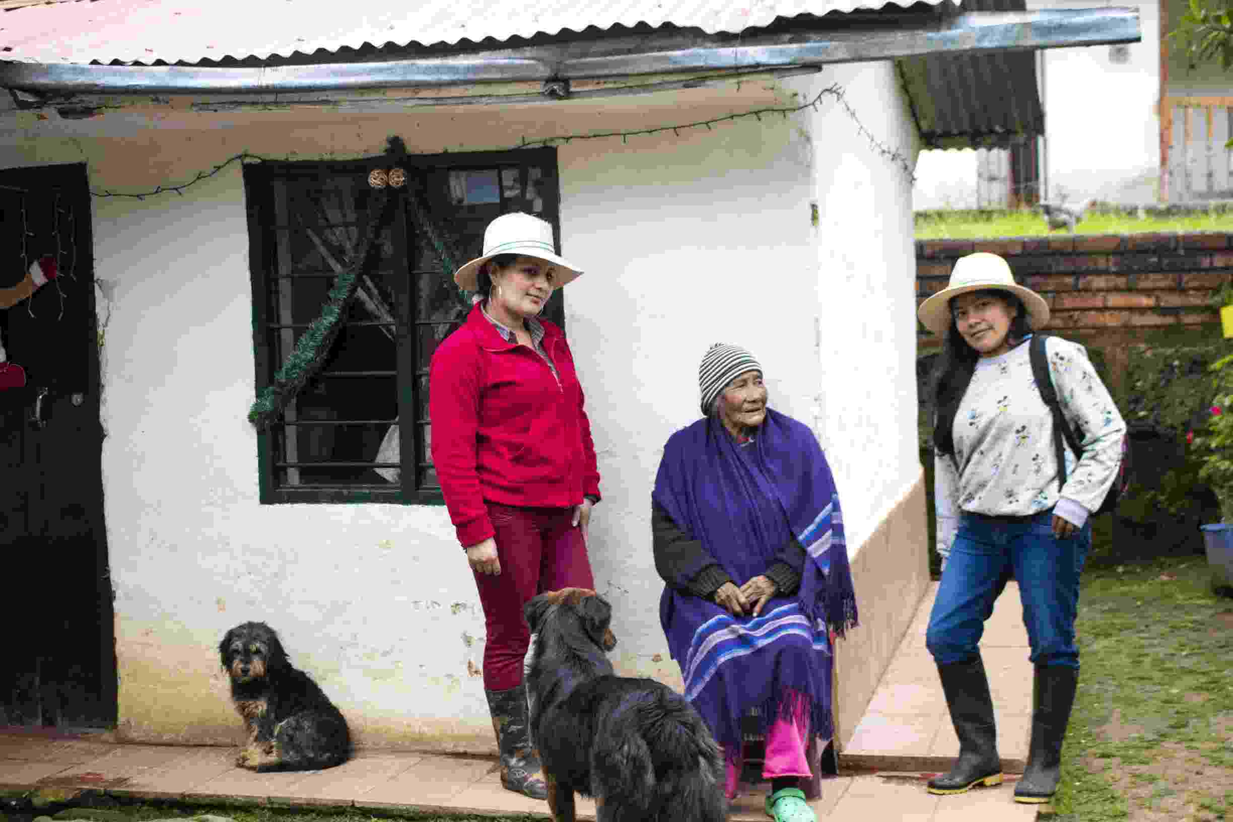
Social cartography was applied in two different communities in the department of Cauca: the reservation of Kisgó, with indigenous actors, and the sub-basin of Las Piedras river, with both indigenous and peasant actors. Each caste study area has distinct territorial contexts and for that reason, the activities of the methodology slightly differed among the two.
In the Kisgó reservation, social cartography was applied to identify the boundaries of the territory according to the cultural worldview of the community. In the participatory workshop, community members were divided into groups according to neighborhoods, and the activity was carried out in 3 steps: i) drawing the limits, biophysical components, and anthropic activities of their territory on a blank sheet of paper, ii) transferring their drawing onto a satellite image map of their territory, and iii) sharing their maps with the rest of the participants, editing their drawings according to feedback. The workshop was followed with a training session teaching the community members how to digitalize their maps on Google Earth and incorporate icons and symbols that represent what they consider to be important activities, landmarks, and strategic areas of their territory.
In the sub-basin of Las Piedras river, social cartography was applied to strengthen planning processes for individual and community farms. In this case, the activity was carried out over three separate sessions: i) creating hand drawn maps of anthropic activities and biophysical components of their territories, ii) drone flights over strategic areas of the territory that were identified during the first session, and iii) co-creation of 3D maps integrating the hand drawn maps with the drone images. These activities will be followed with drone photogrammetry of small scale farms to provide more detailed management tools.
Practicalities
- Social cartography should be approached with systems thinking and inter/transdisciplinarity that integrates the biophysical (GIS software) with the social (ethnographic methods).
- Drone technology is an extremely useful tool for this method, and should be managed by a licensed drone pilot.
- While ArcGIS was the main software utilized in these case studies, free software such as QGIS and Google Earth are adequate alternatives.
Relevance for research on SDGs
The 2030 Sustainable Development Goals aim to improve the current conditions of use, access, and management of natural resources to initiate transitions towards sustainability, where water is especially relevant for the economic, social, political, and ecological activities that sustain socioecological dynamics. Hence, there is great importance in generating management processes that recognize local conditions, the organizational capacity and cohesion of communities based on their knowledge, experiences, and learning, articulated to technological tools that allow for an understanding of this complexity and reduce uncertainty between spatiotemporal scales.
In this way, by thinking about joint management processes based on the dialogue of knowledge, the SDGs of climate action (SDG 15), life of terrestrial ecosystems (SDG 7) and clean water (SDG 6) are directly linked to reduce the impact of land use change and the increase in the agricultural and livestock frontier, as a main strategy of territorial planning.
Key ethical considerations
- An ethics protocol should be established with the leaders of the community in which research activities are being carried out.
- Researchers receive informed consent from community leaders/workshop participants regarding the generation of information and how it will be used.
- Experts on GIS software and cartography are incorporated into the research time to accurately guide learning processes.
- Researchers must make realistic commitments, and not generate false expectations for communities.
Final reflections
- Through application of Social Cartography, maps and integral views are co-created; these are useful for territorial management and planning.
- Social Cartography creates visibility for communities, strengthening processes of recognition and identity.
- Cross-cultural dialogue, or diálogo de saberes, is practiced between people with distinct epistemologies, towards building an integral understanding of territorial realities (Robinson et al., 2016).

Cerro Puzná, Las Piedras river basin
Reflection questions
- How would you apply this method to understand your own territory or area of study?
- What would you add to this methodology to make it more integrated with your field of study?
- What actors have been dominant in defining territorial borders in your region?
- Which communities have been excluded in the process of defining territorial borders in your region?


